
Few corners of the country are as well oiled a machine as the American Southeast when it comes to trail development and advocacy. Enter: S.O.R.B.A. The Southern Off-Road Bicycle Association is a powerhouse advocacy organization made up of 48 chapters throughout the southeastern United States. It has built numerous relationships based on trust and reciprocity with land managers in states including Alabama, Florida, Georgia, Mississippi, North Carolina, South Carolina, and Tennessee. If that seems like a massive swath of real estate, well, it is. Under S.O.R.B.A.’s umbrella is terrain that ranges from the Florida coastline to the highest mountains east of the Mississippi. While either of those two landscapes certainly makes for an intriguing place to ride bikes, it’s the transitional zone between them that we are about to explore today.
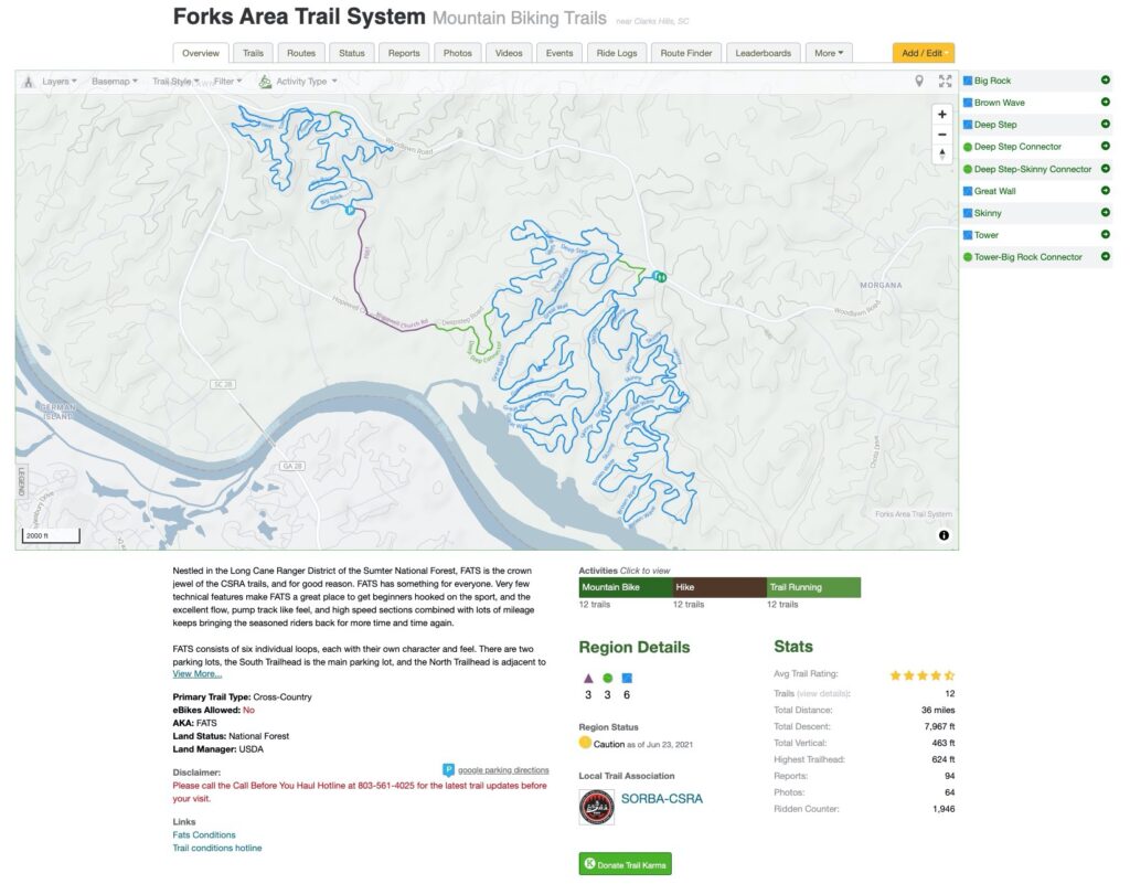
The Savannah River headwaters are located in the heavenly Blue Ridge Mountains, where it begins a 300-mile long journey that ends along the Atlantic Coastline between Hilton Head and Tybee islands. The river acts as a physical delineation between the southern states of Georgia and South Carolina, and midway through its journey is where the Forks Area Trail System (FATS) calls home. Located in South Carolina’s Sumter National Forest and directly across the Savannah River from Augusta, Georgia, FATS comprises 37 miles of trails swoop and dive through dense mixed forest and blackwater swampland.
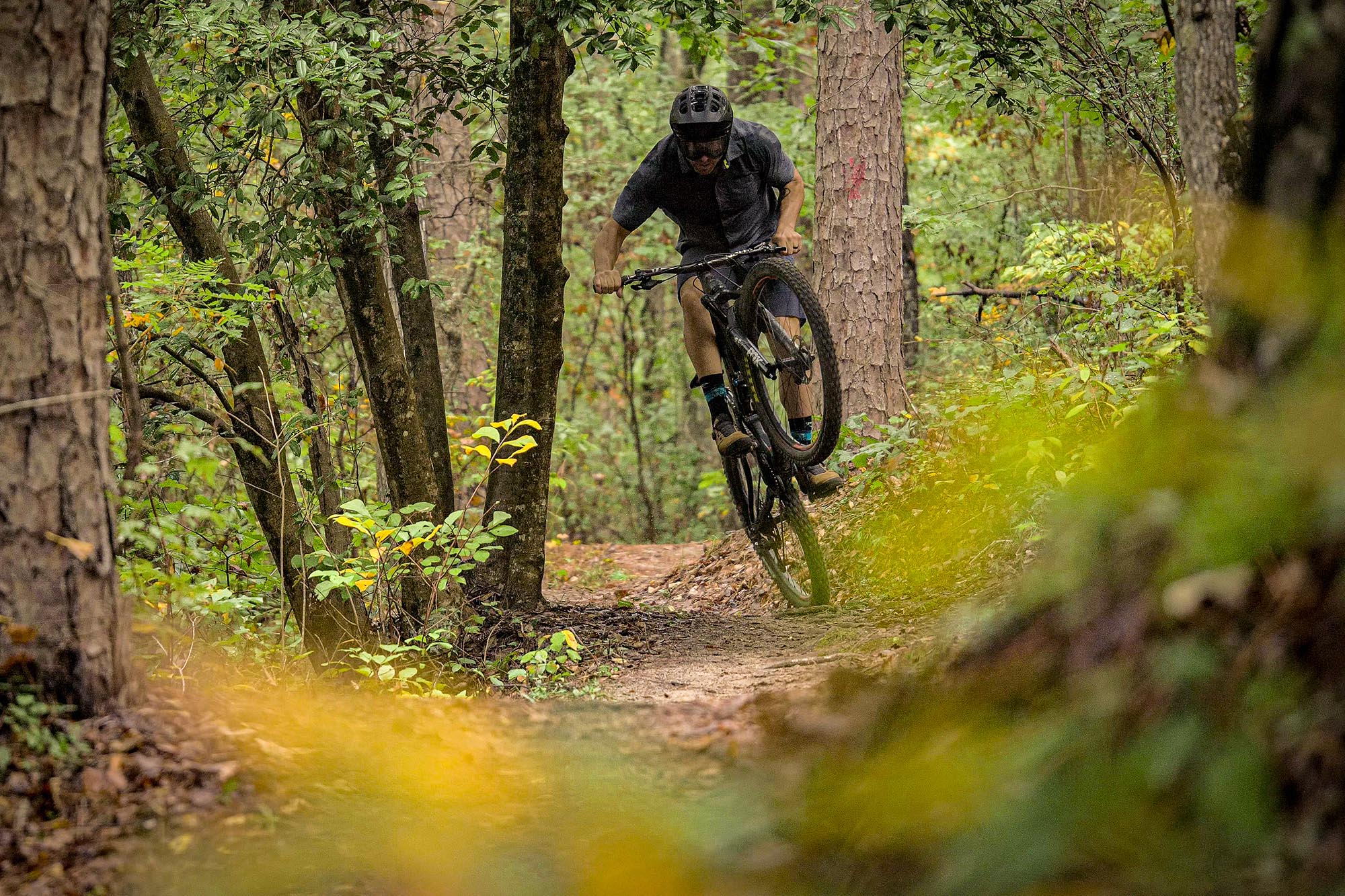
The trails are organized through a series of six main loops, with several miles of connector trails between them. The terrain is rolling and makes for plenty of opportunities for fun and creative trail design. While certainly not mountainous, the elevation gain and loss adds up quickly due to the lumpy nature of the topography. The trails are mainly devoid of any continuous technical features, with a smattering of root gardens and the occasional flat corner, and are by and large of the hardpack flow variety. This is how flow trails were built before they were known as flow trails, and like a lot of trail networks of this age and ilk, warp speeds can be achieved with relative ease.
This is how flow trails were built before they were known as flow trails…
For me, FATS is a great example of how beauty rests squarely within the eye of the beholder. How many people would expect to find over 30 miles of really fun trail sandwiched between bald cypress swamps and modestly hilly terrain that isn’t incredibly close to the mountains or the coast? It’s far from the first choice of locales if people were given their druthers, but it’s yet another example of the power of sweat equity and, of course, the power of the bicycle. Our planet is a lot of things, and a playground is one of them. No need to look any further than in these beautiful swamplands.
ADVOCACY
SORBA CSRA (Central Savannah River Area) is the group tasked with the advocacy and stewardship efforts in this corner of the Southeastern United States. Their trail selection is massive and includes Augusta Canal Singletrack, Bartram, Boyd Pond, Hickory Knob State Park, and of course, the Forks Area Trail System. Comprised of 175 members, SORBA CSRA is dedicated to developing sustainable mountain bike trails throughout the greater Augusta, GA region, which includes many trails across the river in South Carolina. While COVID-19 proved to be a massive disruption for many worldwide in 2020, it wouldn’t stop SORBA CSRA from seeing a record 3,000 volunteer hours, which is nearly triple the annual average. For more information about the group and how you can support them, check out sorbacsra.org.
STAY
Augusta, GA, is 15 minutes away and is the nearest population center to the FATS trails, and is loaded with plenty of lodging options for plenty of budgets. Camping is a popular decision as well, and there are several campgrounds, including Hard Earth, Hamilton Beach, and Hickory Knob.
TAKE NOTE
The hard-packed clay that makes up most trail surface at FATS is notorious for absorbing and holding water after heavy rains, so the local riders kindly ask that you give the trails 24 hours to drain and dry before riding the trails. Look for trail condition updates on Trailforks.


Comments